Development of a piece of farmland into a grassy floodplain for a conservation project in Saint-Ignace-de-Loyola
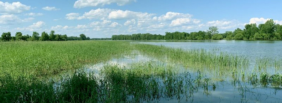
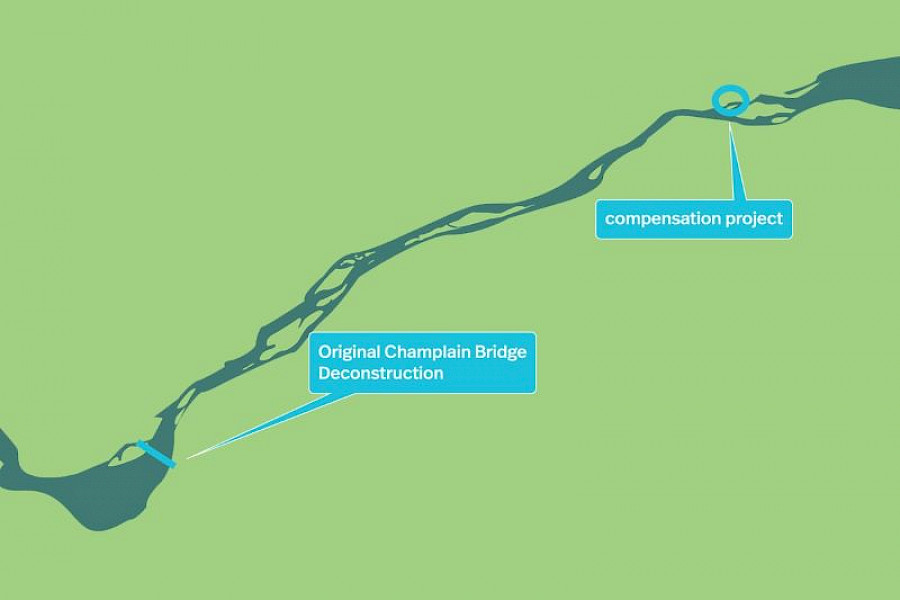
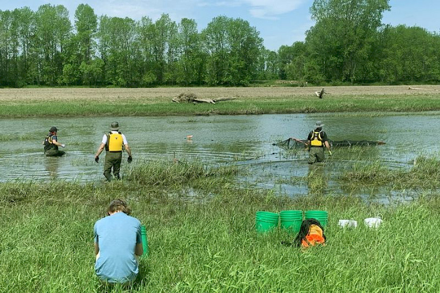
This compensation project consists of developing a piece of farmland on the edge of the St. Lawrence River in the Saint-Pierre Lake archipelago to create areas for fish spawning, that will be developed to allow fish to spawn and create new habitats to promote the diversity of plants and animals, which will preserve biodiversity in this amazing region.
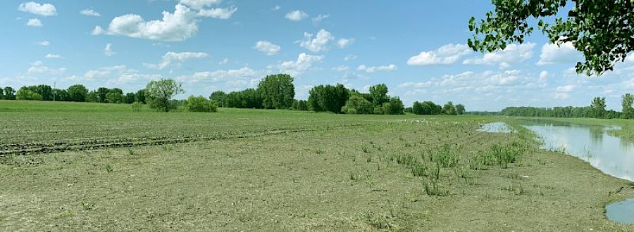
Since the land for this project was used for many years to farm a soy monoculture, the soil is completely exposed all year-round and does not provide sufficient beds for fish spawning. The purchase and development of this farmland will optimize the spawning and fry rearing conditions for spring-breeding fish species that use the floodplain, particularly yellow perch.
- Increase the area of spawning habitat area for yellow perch.
- Allow fish to freely move in the ditches on either side of the farmland.
- Provide shelter and feeding, nesting and other areas for different species of birds, amphibians, reptiles and mammals.
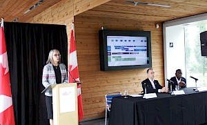
This project is a collaboration between JCCBI and the Nature Conservancy of Canada (NCC). JCCBI is funding the purchase of the property and performing the habitat development work, while NCC will oversee the site’s long-term conservation.
The yellow perch population in Saint-Pierre Lake and its archipelago has been declining for many years. Several factors have worked against yellow perch, such as access to good spawning habitats along the shoreline of Saint-Pierre Lake.
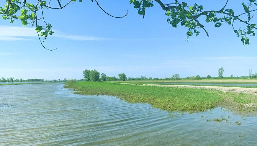
Approximately 5,000 ha of farmland around the lake is located under the 0 to 2 year flood level, i.e. in the lake’s nearshore areas. The farmland in Saint-Ignace-de-Loyola used for this compensation project is no exception, as it is mainly under the 0 to 2 years flood level. This land was used to farm a soy monoculture, a type of crop that does not provide adequate spawning beds for fish in the spring. Maintaining vegetation along the edges of the fields limits the habitat potential for aquatic, avian and land animals during both flood periods and ebb periods.
- Optimize the reproduction and rearing conditions of spring-breeding fish species that use the floodplain, particularly yellow perch;
- Provide an optimal feeding habitat for larval fish by maximizing zooplankton production;
- Improve nesting conditions for waterfowl and farmland birds in the wet grasslands;
- Improve habitat quality and diversity for aquatic, semi-aquatic and land wildlife;
- Improve how fish can freely move between Saint-Pierre Lake, the St. Lawrence River, and their spawning areas;
- Maintain the developed land over time while minimizing long-term maintenance efforts.
- Eliminate the discharge of fine sediment into Saint-Pierre Lake and reduce the risk of proliferation of invasive alien species (IAS) by establishing a permanent native herbaceous cover (wet grassland).
- Planting vegetation to create a vegetation cover to stabilize the farmland against erosion while maximizing the benefits for biodiversity;
- Planting groves of shrubs (alder, willow, dogwood, and others) near the water and around zones to provide good cover for birds and substrates that are suitable for fish spawning;
- Building hillocks to promote plant diversity and biodiversity;
- Creating tracts of biodiversity that can be used by different species;
- Setting up roosts, tree trunks, rock piles and other structures on and around these tracts to create shelters and habitats that can be used by the different animal species that visit the sector;
- Developing protected bays at different depths to encourage fish spawning at different spring flood levels.
Depending on the proposed developments and the water conditions in the area, the gain in multi-species habitats should be approximately 10 hectares. Approximately 6 hectares of this area will be fish habitat developed below the 6.35-m flood level. The developed habitats will be entirely in calm and shallow water that will have aquatic vegetation.
Most of the gains in fish habitat will be sensitive habitats that some species of fish can use to spawn and rear their fry and where many fish species can go to feed. These new habitats will promote plant and animal diversity and help protect biodiversity in this region.
Latest news

The Government of Canada…

The magic of fireworks from…